Services/land Surveying
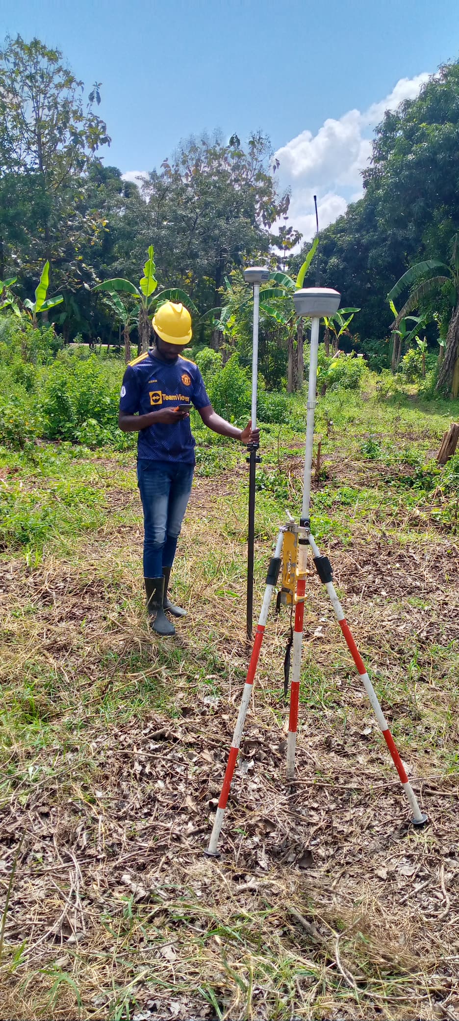
Boundary Opening
Boundary opening is a crucial process in land surveying that involves clearing and marking property boundaries to ensure accurate identification and avoid disputes. This process helps landowners, developers, and government agencies establish precise property limits for construction, fencing, or legal purposes. Our expert surveyors use advanced techniques to locate, verify, and demarcate boundaries in compliance with legal and regulatory standards. For more information or to request a boundary opening service, please contact us.
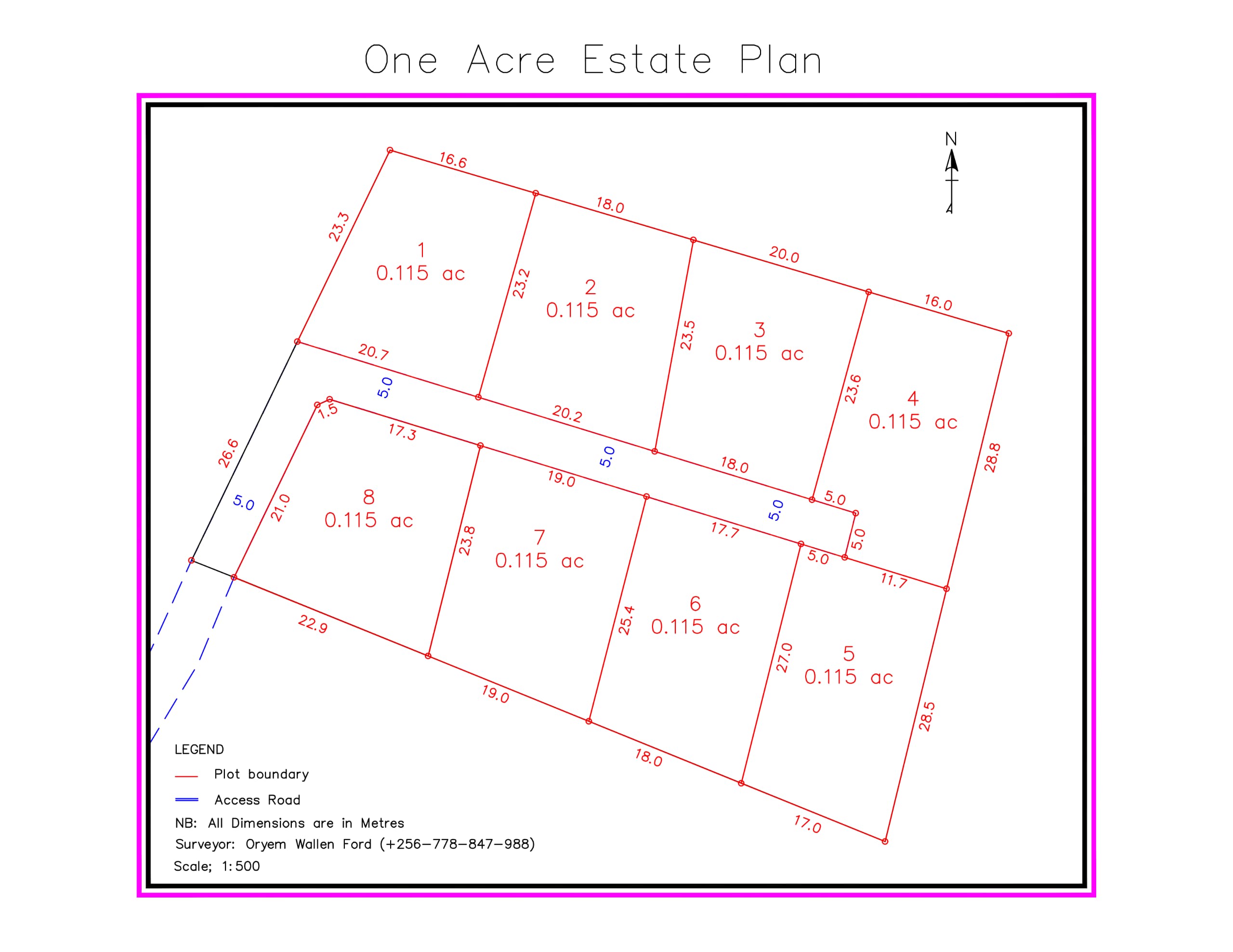
Land sub division
Land subdivision is the process of dividing a larger parcel of land into smaller plots for development, sale, or ownership purposes. This process requires careful planning, accurate surveying, and compliance with legal and zoning regulations to ensure proper land use and infrastructure development. Our team provides professional land subdivision services, guiding you through the entire process, from initial survey to obtaining necessary approvals.
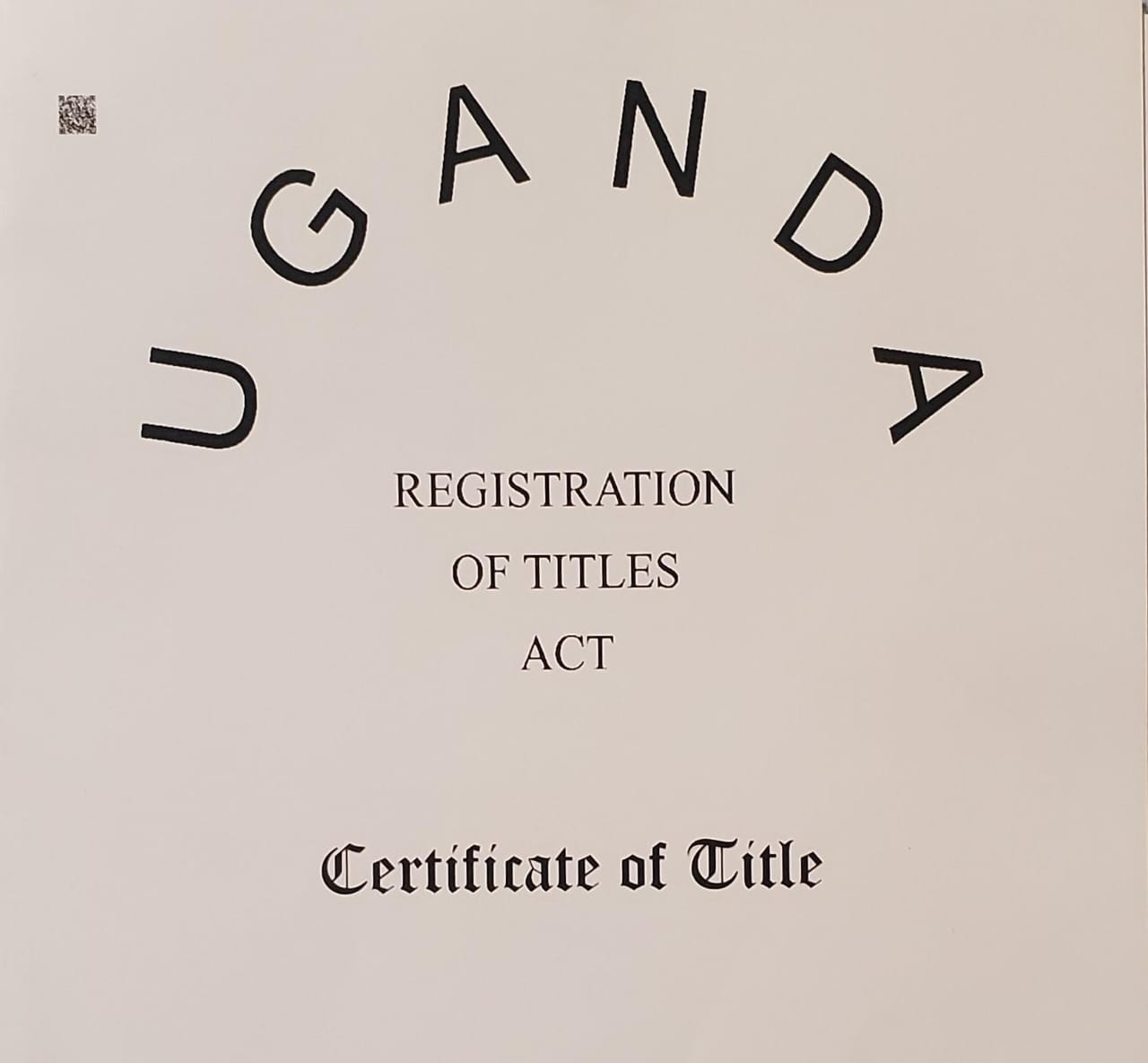
Land Title Processing
Land title processing is the legal procedure of verifying, registering, and obtaining a valid title deed for a property. This process ensures rightful ownership, protects against disputes, and enables legal transactions such as sales, transfers, or development. Our experts assist in every step of land title processing, including document verification, application submission, and follow-ups with relevant authorities to ensure a smooth and hassle-free experience.
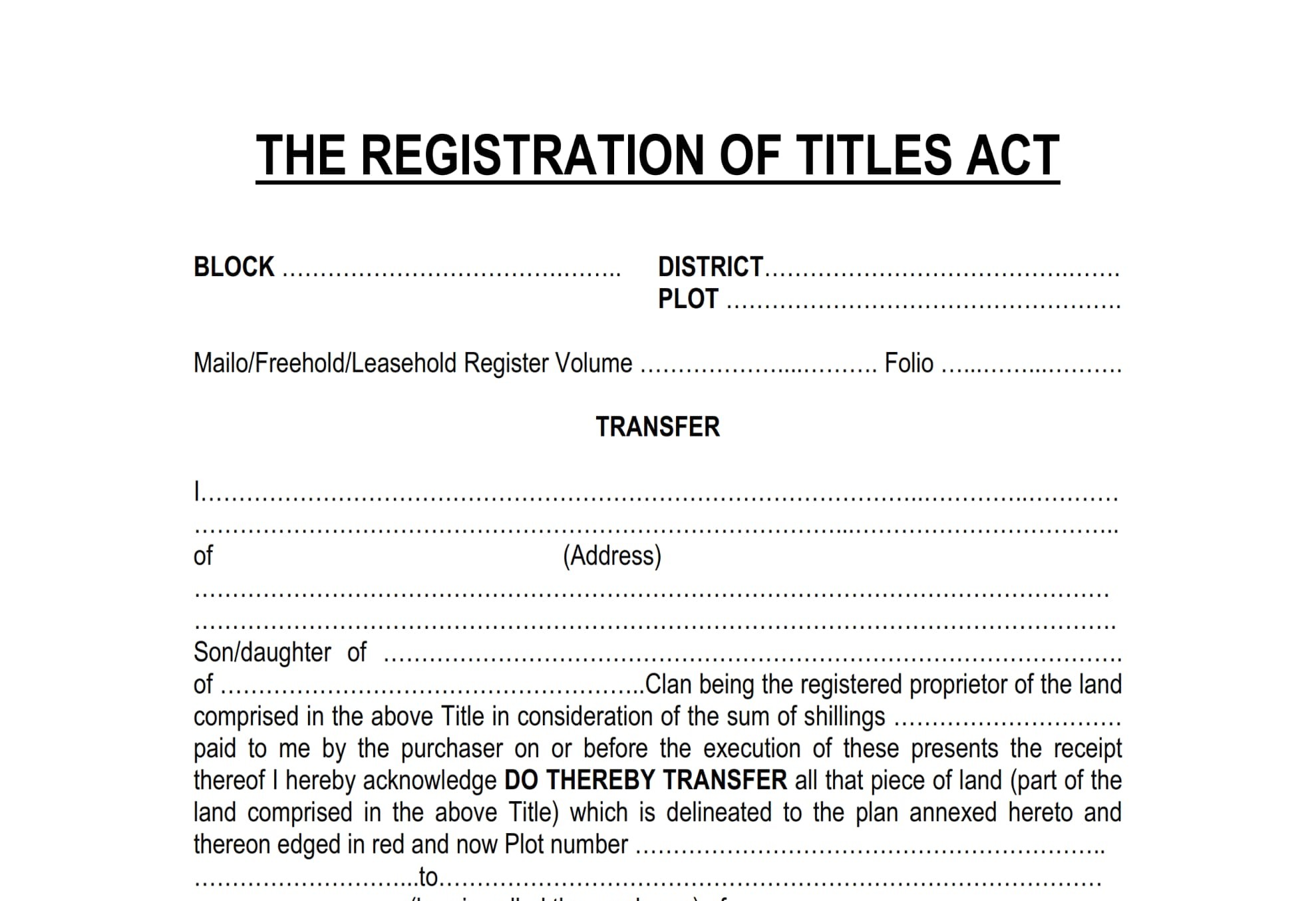
Land Title Transfers
Land title transfer is the legal process of changing property ownership from one party to another. This process involves verifying ownership, preparing necessary documents, and registering the transfer with relevant authorities to ensure a seamless and legally binding transaction. Our team provides professional assistance in land title transfers, ensuring compliance with legal requirements and minimizing delays. Whether buying, selling, or gifting property, we guide you through every step for a smooth transfer process.
Land Title Search Letter
A land title search is the process of verifying the legal status, ownership, and any encumbrances on a property before making a transaction. This ensures that the land is free from disputes, unpaid liabilities, or legal restrictions. Our experts conduct thorough land title searches to provide accurate and up-to-date information, helping you make informed decisions when buying, selling, or developing property.

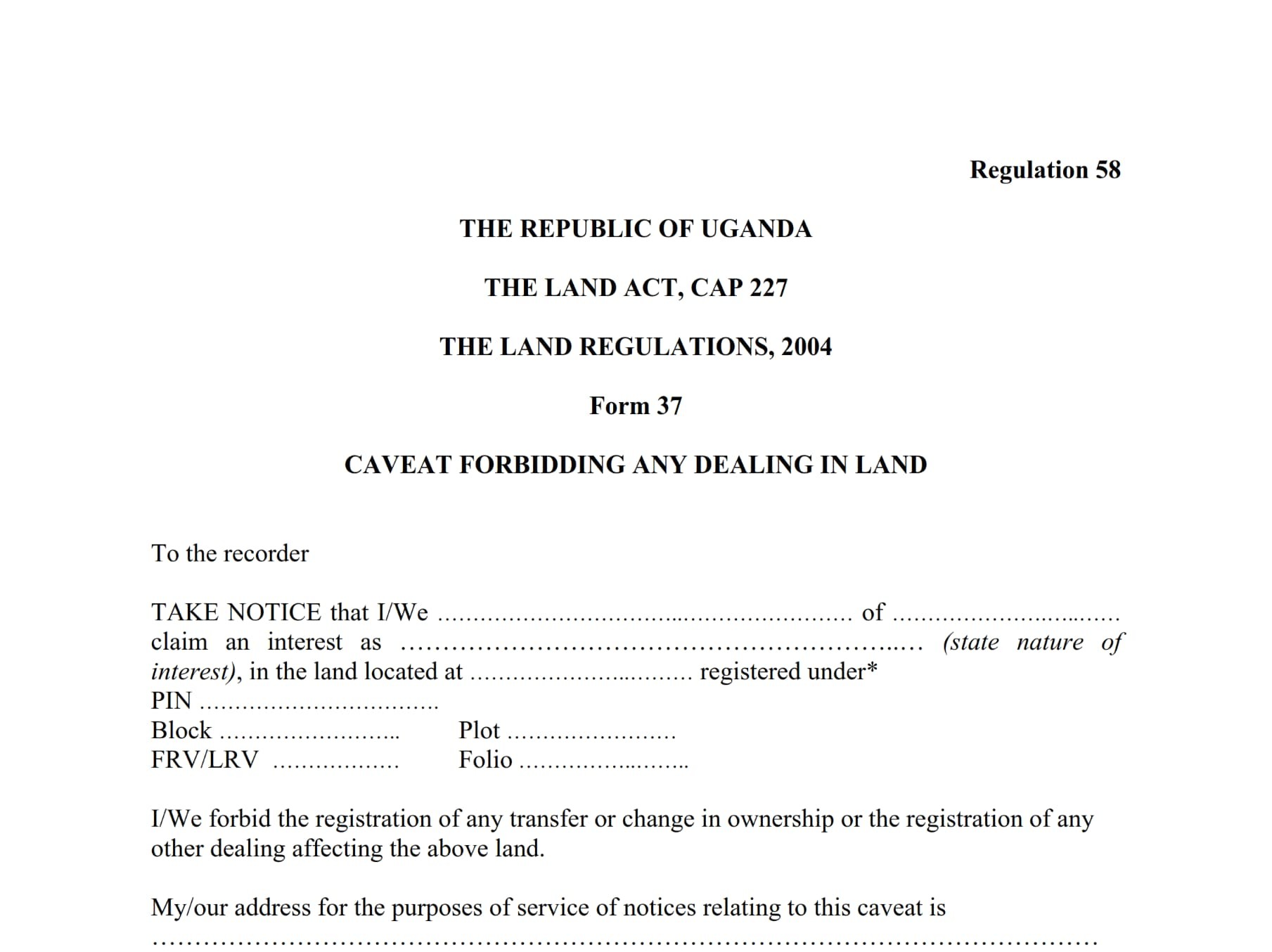
Land Related Documentation
Land-related documentation involves the preparation, verification, and processing of legal documents required for property ownership, transfer, development, and compliance. Proper documentation ensures transparency, protects ownership rights, and prevents disputes. Our team provides expert assistance in handling land documents, including; title deeds, survey reports, lease agreements, lodging and removal of Caveat, regulatory approvals, ensuring accuracy and legal compliance.
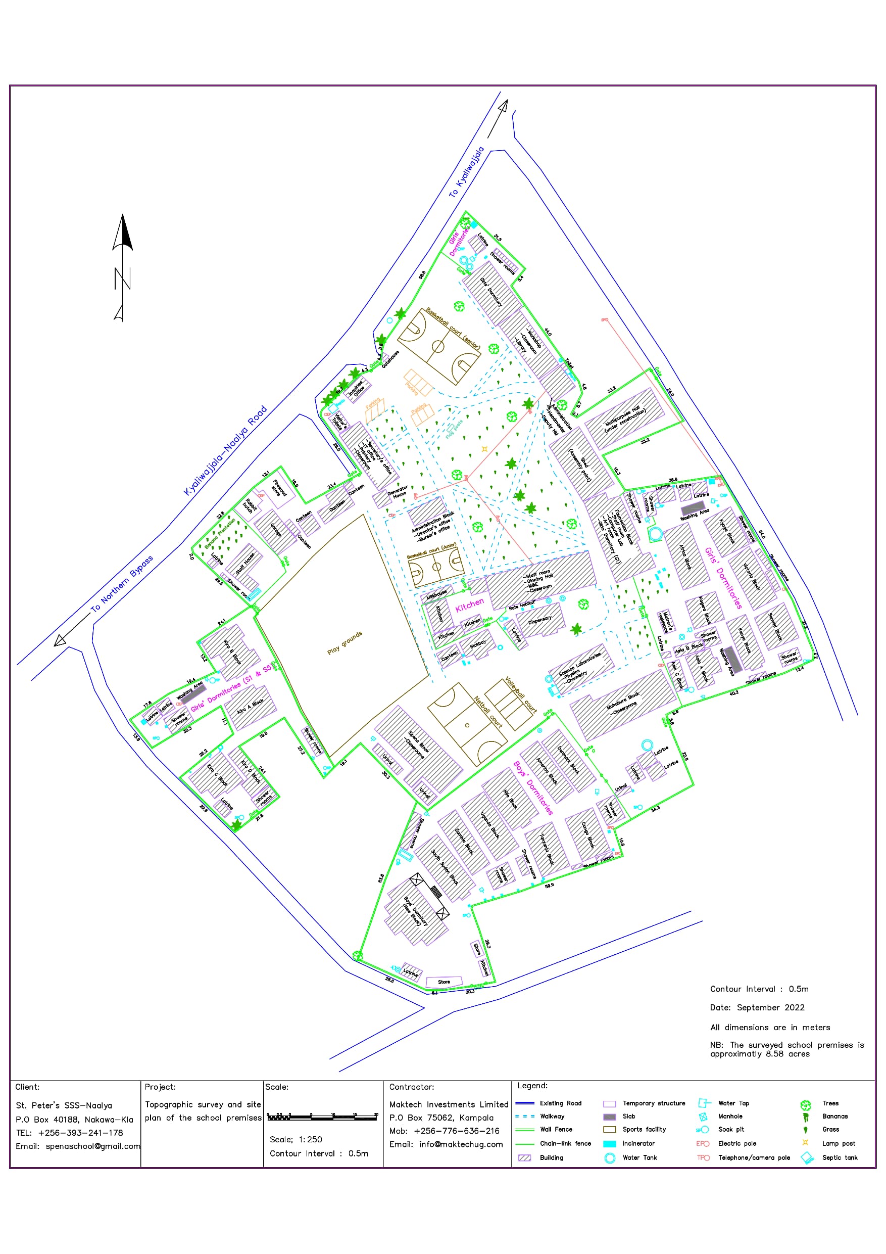
Topographic Surveying
Topographic surveying is the process of mapping and measuring the natural and man-made features of a land surface, including elevations, contours, trees, buildings, roads, and other structures. This survey is essential for planning construction projects, land development, and environmental assessments. Our skilled surveyors use advanced technology to provide accurate topographic data, ensuring precise project planning and execution.

Planimetric Surveying
Planimetric surveying focuses on mapping the horizontal features of a land surface, such as roads, buildings, rivers, and property boundaries, without considering elevation or contour details. This type of survey is essential for urban planning, infrastructure development, and cadastral mapping. Our expert surveyors use advanced techniques to produce accurate planimetric maps for various applications, ensuring precision and reliability.
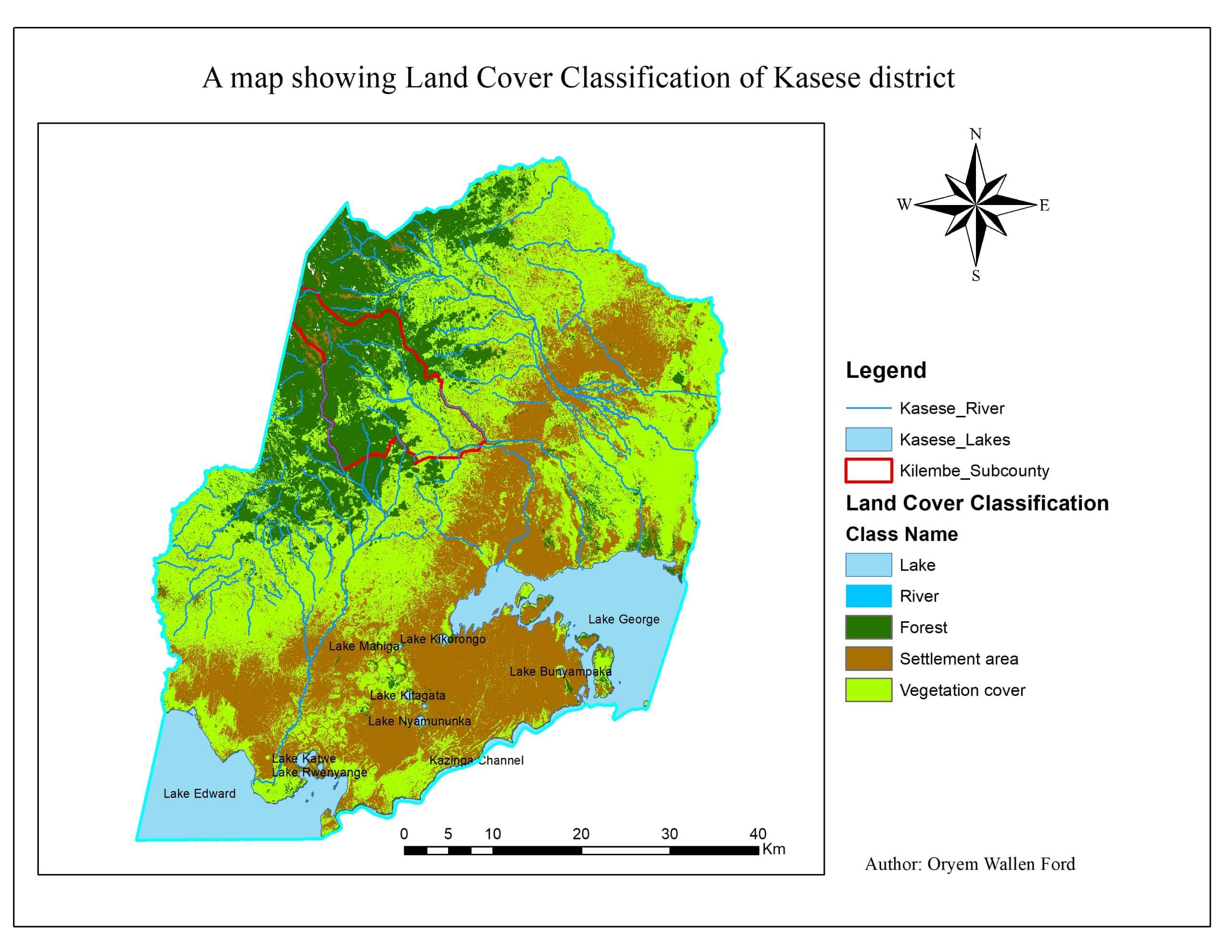
Remote Sensing and GIS Mapping Solutions
Remote sensing and GIS (Geographic Information System) mapping solutions provide advanced tools for capturing, analyzing, and visualizing spatial data. These technologies are essential for land management, urban planning, environmental monitoring, and infrastructure development. Our team utilizes cutting-edge satellite imagery, aerial drones, and GIS software to deliver accurate and detailed mapping solutions tailored to your needs.
Let's Begin Your Journey
Call Us: 0754 212082 Email Us: infinityinsights24@gmail.com